Marine Sonar and Radio Survey Equipment
Welcome to our comprehensive catalog of marine survey equipment, designed to prioritize performance and diver safety in every subsea operation. Easily and accurately find the products you need to map the depths and track divers, simplifying even the most dangerous operations. We tailor our hydrographic survey equipment to meet the exacting needs of the bridge/structure inspection and search and rescue industries.
Ensure safety and accuracy in every mission. Equip your team with the best gear. Explore our Kongsberg and GeoAcoustic products today. Then, contact us for more detailed product specifications.
Get a Quote for Your Marine Survey Equipment Needs
Gardner Technologies Inc. partners with leading manufacturers Kongsberg and GeoAcoustics to deliver a range of hydrographic survey systems.
Kongsberg Mesotech: Pioneers in Marine Sonar Equipment
For over fifty years, Kongsberg Mesotech has been at the forefront of marine sonar technology, shaping the future of underwater exploration and operations. They design and manufacture a range of underwater acoustic products that can withstand even the harshest conditions. Their product list includes forward-looking / multibeam sonar, sonar processing software, and more.
As a global leader, Kongsberg’s bathymetric technology sets the standard for efficiency, reliability, flexibility, and environmentalism. Their survey equipment is used for various important tasks, including specialized applications with Remotely Operated Vehicles (ROVs).
- Obstacle Avoidance
- Pipeline Survey
- Target Detection
- Underwater Construction Support
- Underwater Inspection
- Seafloor Mapping
- Environmental Research
- Defense
- Offshore Decommissioning
- Search And Recovery
- Diver Safety
Explore a selection of Kongsberg’s extensive product range below. We will tailor solutions to your unique demands.
When you work with Gardner Technologies Inc., you get more than just an underwater camera. You get a tailored solution. We understand which equipment your application demands. Contact us to quickly find a solution that meets all safety, security, and reliability requirements.
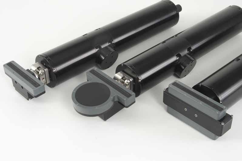
High Resolution 1171 Sonar Heads
- Simultaneous multiple scanning sonar heads and altimeter
- Narrow horizontal beam pattern for superior image quality
- Tunable frequency transducers, exposed to eliminate acoustic lensing
- Pre-plot search and survey lines, geo-reference sonar targets
- Data Mosaicking enhances data visualization and analysis
- Operating Depth: 650 m to 11,000 m
- Telemetry: RS485/RS232 compatible
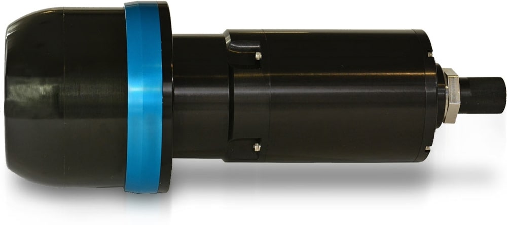
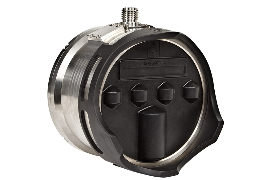
Domed Scanning Sonar
- Patented Acoustic Lens Technology: Maintains beam focus through temperature and depth changes
- Operating Depth: 4000 m
- Telemetry: RS485 or RS232 asynchronous serial data
- Maximum Range: 50 m to 300 m
- Minimum Range: 0.5 m
- Range Resolution: ≥3.75 mm
- Scan Speed: Typical: 3.7 sec/360° @ 5 m and 1.8° step size (@ 460 kbps)
- Scan Angle: 360°
Dual Axis Scanning Sonar
- Profiling system tailored for long-term seabed or structure monitoring
- Vital for tracking sediment scour and aggregation dynamics
- Rugged design ideal for high-current and harsh offshore environments
- Outputs a 3D profile-point digital data string for detailed analysis
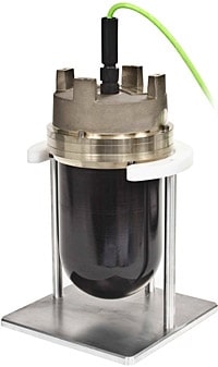
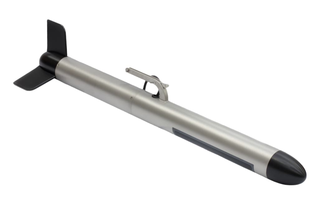
Underwater Altimeters – 1107 Series
- Robust design and easy output configurations
- Range of models and frequencies available to cater to different specifications
- Operating Depth Options: 3,000 m, 4,000 m, 6,000 m, and 11,000 m
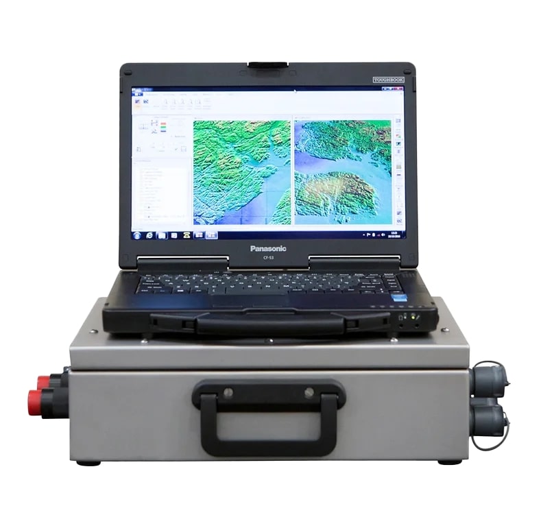
M3 Portable Hydrographic System & Forward-Looking Sonar
- Compact multibeam sonar head, user-friendly interface unit, and commercial laptop
- Combines single-beam image quality with multibeam speed
- No accuracy degradation during turns in roll, pitch, and heave measurements
- Laptop preloaded with user-specified survey software, along with the M3 Software
- Operating Depth: 4000 m.
- Compliant with IHO Special Order & 1A standards
- Vertical Accuracy: +/-60° sector
- Target Detection: Up to 40 m
Flexview Multibeam Sonar
- Provides high-quality distortion-free images and 200 m coverage over a 140° sector
- Removable Transducer enables field replacement in case of a catastrophic impact
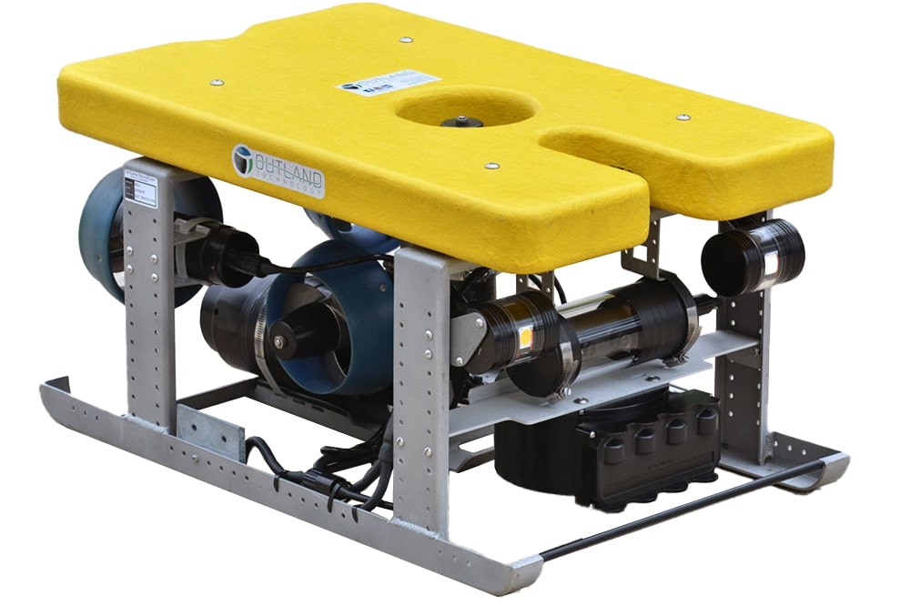
- Ideally suited for small observation class ROVs
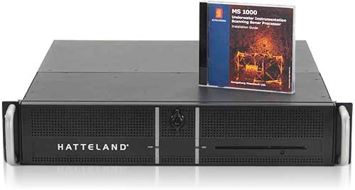
Sonar Processing Software – MS1000
- Microsoft® Windows-based full-function sonar processing application
- Configurable to control digital scanning sonars and altimeters
- Industry-standard telemetry interfaces
- No additional hardware
- Integrated Features:
- Helmsman Display
- Survey line planning
- Survey area coverage display
- Survey map/chart planning
- Survey map/chart planning
- GeoTiff Files importing
- Coordinate conversion, projection, and Datum shift
- Sonar location calibration
- Event recording and replay
GeoAcoustics: Map the Depths with Cutting-Edge Sonar
Since 1978, GeoAcoustics has been a trusted manufacturer of high-end sonar equipment for side scan and sub-bottom profiling. As a leader in marine technology, they offer an extensive range of innovative hydrographic surveying solutions designed to push underwater exploration and safety.
GeoAcoustics state-of-the-art marine sonar systems and survey equipment redefine industry standards. They focus on a few key hydrographic technologies:
- Bathymetry Sonar: Uncover the intricate details of underwater topography with GeoAcoustic cutting-edge bathymetry sonar equipment.
- Sidescan Sonar: Obtain crystal-clear images of the seafloor and submerged objects with GeoAcoustic high-resolution sidescan sonar technology.
- Sub-bottom Profiling: Gain valuable insights into underwater sediments and geological features for informed decision-making.
Discover a new standard of excellence with GeoAcoustics. We can help you find the perfect products.
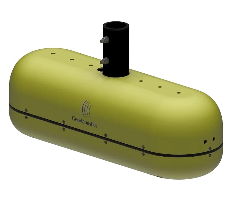
GeoSwath 4 – AI-Enabled Wide Swath Bathymetry and Side Scan Sonar
- Comprehensive turnkey solution for bathymetry mapping
- Generates final bathymetry map and side scan mosaic
- Dual transducer head with versatile mounting options for flexible deployment
- 240° field of view from nadir to waterline
- Enables bottom coverage up to twelve times water depth
- Available in 125, 250, or 500 kHz
GeoSwath 4R – AI-Enabled Ruggedized Wide Swath Bathymetry and Side Scan Sonar
- Designed for simultaneous swath bathymetry and side scan sonar mapping in shallow waters
- Ideal for surveying in rough conditions
- Features a compact, splash-protected deck unit and ruggedized laptop
- Wide 240° field of view from nadir to waterline
- Bottom coverage up to twelve times water depth.
- Available in 125, 250, or 500 kHz
Pulsar – Towed Sidescan Sonar
- Non-specialist personnel can operate it to conduct effective surveys quickly
- Allows users to plan and conduct surveys, acquire sonar data with embedded positioning information, and visualize data in real-time
- Selectable FM or CW pulses to optimize range and resolution for specific survey needs
- Frequency range: 550 kHz to 1 MHz.
GeoPulse Compact OTS – Side-Mounted Sub-Bottom Profiler
- Wide frequency range and high output power (up to 1 kW) for versatile surveying capabilities
- Operating power of 10 – 30 VDC (30 W) for low energy consumption
- Functional down to depths of 100 m+ with impressive penetration up to 80 m
- Offers exceptional performance with minimized potential for user error
Kongsberg Seatex: Precision in Maritime Communication and Motion
Kongsberg Seatex is an experienced innovator in maritime technology. They specialize in broadband radio, motion sensors, inertial, and GPS technologies. They have been in this industry for over 25 years.
Unparalleled Motion Reference Units (MRUs)
Since its inception in 1992, Kongsberg Seatex has changed how to measure motion with its Motion Reference Units (MRUs). With over 15,000 units deployed worldwide, these cutting-edge devices provide real-time, dynamically accurate data on motion.
MRUs are necessary for tasks that need precise data on roll, pitch, yaw, and heave motion. These tasks include monitoring wave height and ensuring safe crane operations in rough weather.
Reliable Maritime Radios
In the maritime world, swift and dependable communication is non-negotiable. Kongsberg Seatex engineers the Maritime Broadband Radios (MBRs) for precisely this purpose. Tailored for maritime applications, these high-speed digital communication systems create a robust “information highway” for seamless data transfer.
Customized Solutions for Your Unique Needs
While MRUs and MBRs are the spotlighted offerings, Kongsberg Seatex and GTI offer a range of solutions to meet your specific requirements. Let us help enhance your motion measurement accuracy or establish a reliable digital communication link at sea.
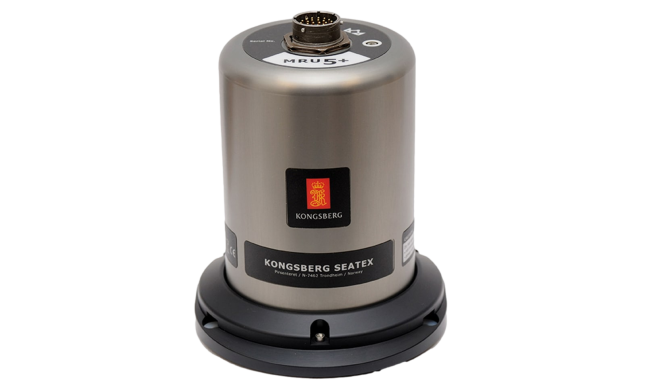
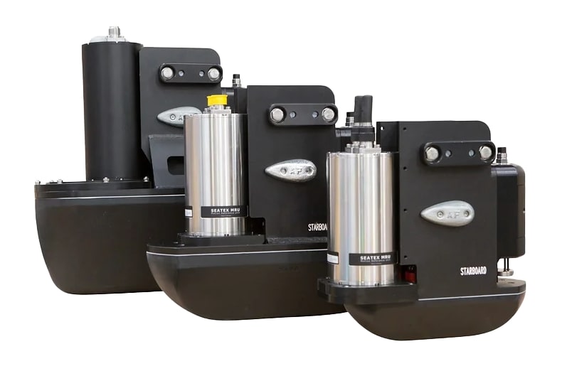
Motion Reference Unit – MRU
- Designed for precise attitude determination and motion compensation
- Utilizes solid-state gyros and accelerometers for real-time, dynamically accurate motion measurements
- Suitable for a wide range of vessel sizes and installations
- Available with a range of accessories
- Depth rated from 10 m to 4,000 m
- Tailored to specific roll/pitch, acceleration, heave, and period requirements
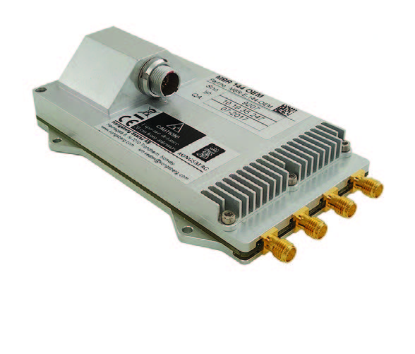
Maritime Broadband Radio – MBR 144 OEM
- Compact, lightweight version within the MBR family
- Frequency Band: 4900 MHz to 5900 MHz
- Channel Bandwidth: 20 MHz
- Tx Power: Up to 2 W
- Modulation: GMSK
- Antenna Connectors: 4, SMA
- Antenna Coverage: Omni-directional, 360 degrees azimuth
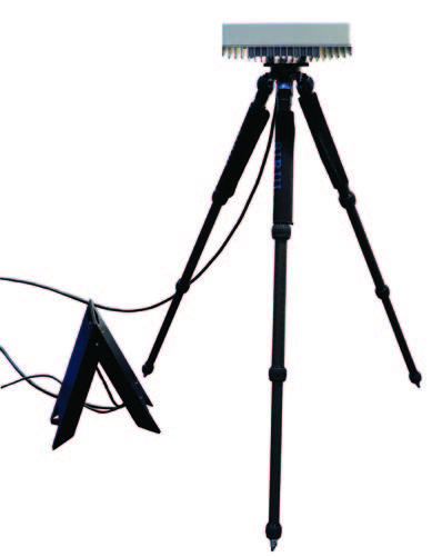
MBR 179 MK2 PORTABLE
- Perfect for scenarios demanding rapid deployment and temporary operation
- Includes MBR 179 MK2 radio, tripod, and cables
- Designed for both shore-based and vessel use
- Ensures resilient high-speed communication and high-capacity data transfer
- Frequency Band: 5725 MHz to 5850 MHz
- Channel Bandwidth: 20 MHz
- Antenna Gain: 21 dBi
- EIRP: Up to 51 dBm
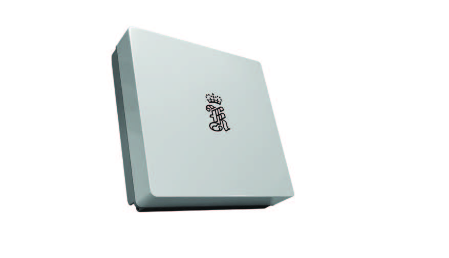
MBR 189 MK2
- Smart antenna designed for high-speed communication and high-capacity data transfer
- Real-time beamforming technology, dynamically adjusting antenna direction for each transmitted IP datagram within a 100° x 100° sector
- Mount multiple radios together for expanded coverage up to 360° azimuth
- Frequency Band: 5725 MHz to 5850 MHz
- Channel Bandwidth: 20 MHz
- Tx Power: Up to 1 W
- Antenna Gain: 24 dBi
- EIRP: Up to 54 dBm
- Modulation: GMSK
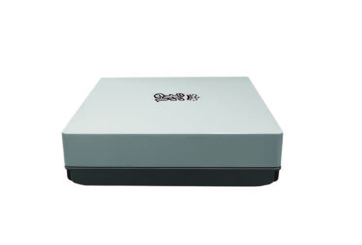
MBR 189 MK2 PORTABLE
- Includes MBR 189 MK2 radio, tripod, and cables
- Designed for versatile usage and quick deployment on shore and aboard vessels
- Real-time beamforming technology
- Mount multiple radios together for expanded coverage up to 360° azimuth
- Resilient in various environmental conditions.
- IP66 ingress protection rating
- Frequency Band: 5725 MHz to 5850 MHz
- Channel Bandwidth: 20 MHz
- Antenna Gain: 24 dBi
- EIRP: Up to 54 dBm